

Playa Coyote, Costa Rica: A Complete Visitor's Guide
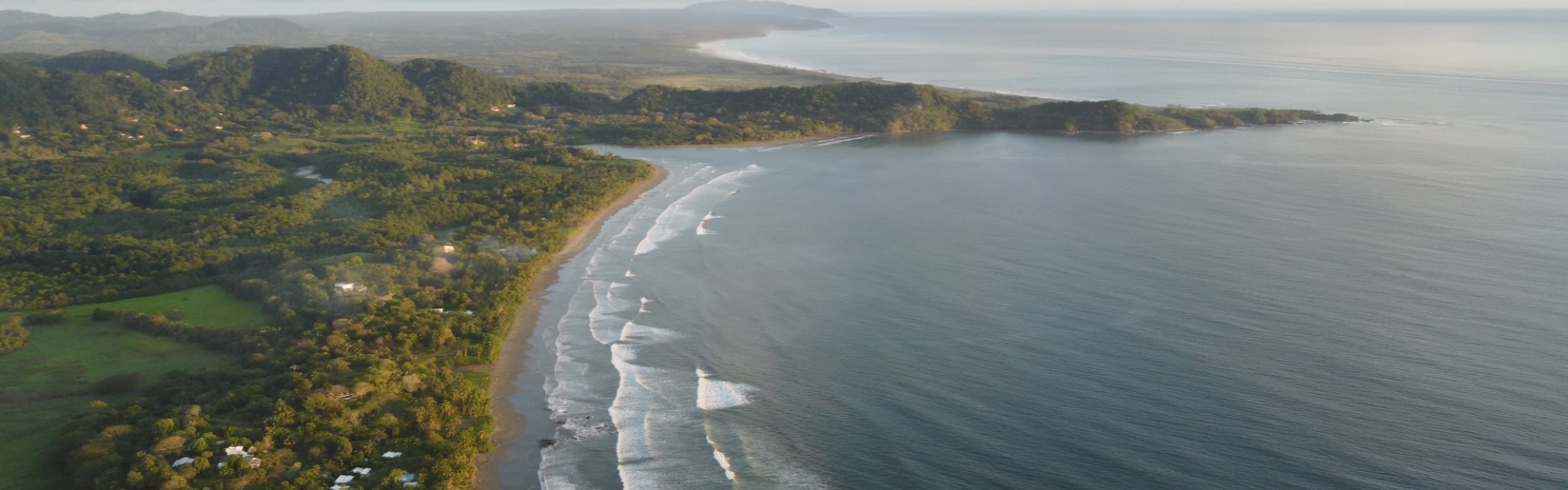
Playa Coyote is a long, palm-lined beach in the canton of Nandayure, on the southern Nicoya Peninsula in Guanacaste, about 83 miles (133 km) by road from Liberia's international airport. It is known for a sheltered swimming bay at Punta Coyote, a mangrove estuary, a turtle refuge next door and an unhurried pace.
Where is Playa Coyote?
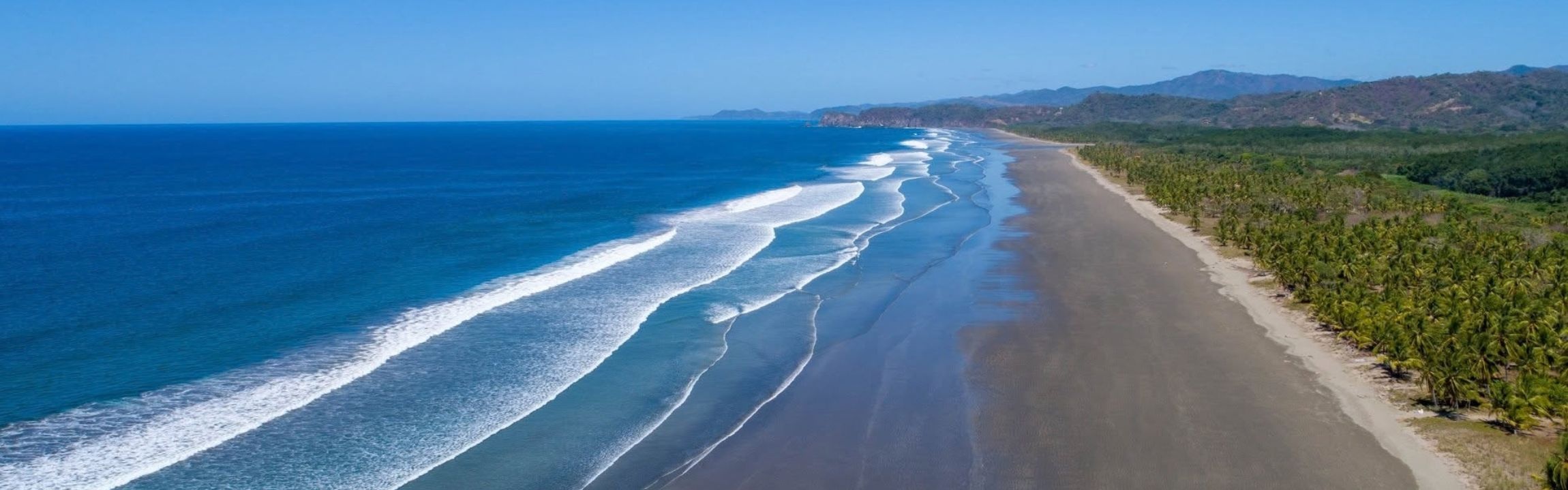
Playa Coyote is in the district of Bejuco, canton of Nandayure, on the Pacific side of the Nicoya Peninsula. Its service village, San Francisco de Coyote, sits about 3 miles (5 km) inland, with the shops, the clinic and the bus stop. For the wider picture of the province, see our overview of Guanacaste.
The beach is part of one long, continuous shoreline that continues north toward Playa San Miguel. Locals divide Playa Coyote itself into two parts, separated by the Río Jabillo and its mangrove estuary:
-
Playa Costa de Oro, the northern half, a long stretch of sand backed by coconut palms.
-
Punta Coyote, the southern half, a horseshoe bay sheltered by a rocky headland.
There is no crossing at the river mouth, so moving between the two means a short drive back through San Francisco de Coyote. It is worth knowing before you set out on foot with a cooler.
Why do visitors fall for Playa Coyote?
Space is the first thing most people mention. Even in the dry season, it is common to walk a long way on Playa Coyote before passing anyone.
The second is the variety within a few minutes of each other: calm water in the bay, surf near the point, birdlife in the estuary and a protected turtle nesting beach just past the headland.
The third is the setting. The coast faces the open Pacific, so sunsets land straight over the water, and the hills behind the beach stay green for most of the year.
How do you get to Playa Coyote?
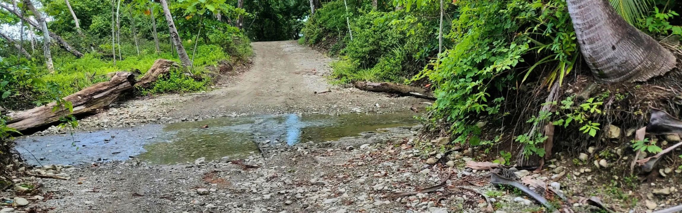
Most visitors drive, and the final stretch to the beach is gravel. The times below are Google Maps estimates to San Francisco de Coyote, checked in September 2026 under normal traffic. The beach is a few minutes further.
| From | Distance | Estimated drive | Route |
|---|---|---|---|
| Liberia (LIR airport) | 83 mi (133 km) | About 2 h 40 min | Route 21 through Nicoya |
| San José (SJO airport), by road | 144 mi (231 km) | About 5 h | Route 27 or Route 1, then the Tempisque bridge |
| San José (SJO airport), with the ferry | 98 mi (158 km) | About 4 h 50 min, plus waiting time at the dock | Route 27 to Puntarenas, ferry to Playa Naranjo |
| Sámara | 28 mi (45 km) | About 1 h 30 min | Route 160 south along the coast |
| Santa Teresa | 23 mi (37 km) | About 1 h 15 min | Route 160 north along the coast |
Taking the ferry to Playa Naranjo
The ferry between Puntarenas and Playa Naranjo is run by Coonatramar. Its timetable changes by season, and the company updated its regular schedule in July 2026. Check the current Coonatramar schedule and its social channels before you leave.
Driving the coastal road
The coastal route between Santa Teresa and Playa Coyote crosses several rivers. The largest, the Río Bongo, is usually fordable only in the driest months. The rest of the year, the bridge at Río Frío is the reliable way across, and it adds a little time to the estimates above.
Most rental contracts exclude damage from driving through rivers, so the bridge is the better choice in a rental.
Vehicles are not allowed on the sand. Article 133 of Costa Rica's traffic law, Law No. 9078, prohibits driving on the country's beaches, with narrow exceptions such as launching boats and emergencies. On this coast the rule also protects turtle nests.
Do you need a 4x4 for Playa Coyote?
A high-clearance car handles the approach in the dry season. From May to November, we recommend four-wheel drive for peace of mind on the gravel sections.
Fill the tank in Nicoya, Sámara or Jicaral before the coastal stretch, and plan to arrive in daylight while you learn the roads.
When is the best time to visit Playa Coyote?
Playa Coyote sits in the North Pacific climate region, as defined by the Instituto Meteorológico Nacional (IMN, the national weather service). According to the IMN's regional climate description, the dry season runs from December to March, with March the driest and hottest month.
The green season runs from May to November. Rain peaks in September and October, and storms tend to arrive in the afternoon and early evening, which often leaves mornings clear for the beach. July and August usually bring a drier spell known locally as the veranillo.
Our advice: December to March is the easiest window for a first visit. July and August are an excellent second choice, with green hills, quieter beaches and active turtle nesting. For current conditions, check the IMN regional forecast and select the Pacífico Norte region.
What is there to do in Playa Coyote?
The things to do in Playa Coyote are mostly outdoors and set by the tide. A tide table is the most useful thing to check each morning.
-
Swim at Punta Coyote. The headland shelters the southern bay, and at low tide the water stays shallow a long way out.
-
Surf near the point. The breaks around Punta Coyote work best when south swells arrive, while the bay itself stays gentler.
-
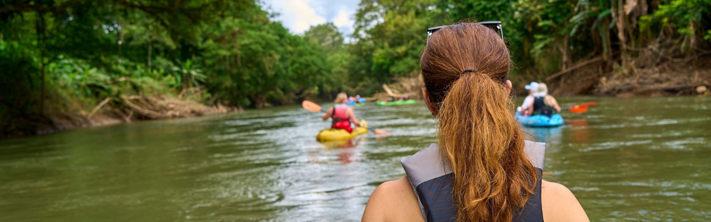
Paddle the Río Jabillo estuary. A rising tide is the best time for herons and kingfishers. Crocodiles live in the estuary, so enjoy the river from a kayak and swim at the beach instead.
-
Walk Playa Costa de Oro. Low tide opens a wide, firm strip of sand heading north toward Playa San Miguel.
-
Join a turtle conservation visit. The Caletas-Arío refuge begins at Punta Coyote. More on that below.
-
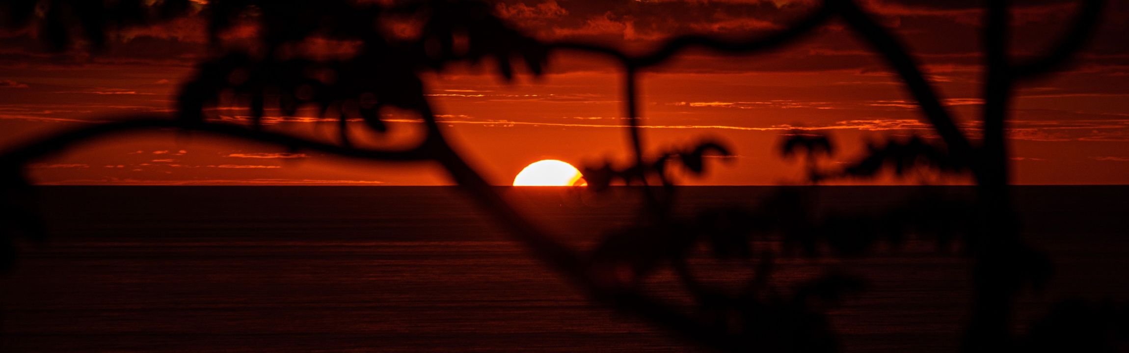
Watch the sunset. The beach faces west over open water, with the headland framing the southern end.
What is the Caletas-Arío wildlife refuge?
The Refugio Nacional de Vida Silvestre Caletas-Arío (Caletas-Arío National Wildlife Refuge) is a protected area created on August 11, 2006, by executive decree 33232-MINAE. It is managed by SINAC, the national system of conservation areas, through its Área de Conservación Tempisque. It covers the beaches of Caletas, Pencal and Arío and a marine zone offshore, and it begins at the rocky point of Punta Coyote.
The refuge protects sea turtle nesting sites. Asociación CREMA, a Costa Rican conservation group, described it in October 2019 as an important nesting beach for the olive ridley turtle (tortuga lora).
Playa Coyote shares in that work. Since 1998, the Playas de Anidación Nicoya Sur project (PLANS) has worked with coastal communities and SINAC to protect nesting beaches that include Caletas and Costa de Oro, according to a 2011 paper in the Revista de Ciencias Ambientales of the Universidad Nacional.
How can you visit responsibly?
Night visits to a nesting beach should always be guided. Two options:
-
CIRENAS (Centro de Investigación de Recursos Naturales de la Península de Nicoya) runs a biological station on Hacienda Arío, inside the refuge area. It carries out beach patrols, hatchery monitoring, environmental education and volunteer programs, and it coordinates educational visits.
-
Namaterra, a Costa Rican ecotourism agency, has organized multi-day trips to the refuge and the CIRENAS station, with night walks led by naturalist guides certified by the Instituto Costarricense de Turismo. Check its site for upcoming dates.
On the sand, follow the guide's instructions on lights and distance. Turtles are easily disturbed while nesting.
Where should you stay in Playa Coyote?
Accommodation around Playa Coyote is small scale and personal: boutique hotels, hillside lodges, vacation homes and camping. For December to March, reserve early.
-
Casa Caletas. A boutique hotel at Punta Coyote beside the estuary, with a pool and restaurant, taking reservations as of September 2026.
-
Hotel Punta Islita, Autograph Collection. A hillside resort above Playa Islita, north along Route 160, included in the MICHELIN Guide's hotel selection.
-
Vacation homes. Many sit behind Playa Costa de Oro and Playa San Miguel, or on the hills above them with ocean views.
-
Camping. There is a camping and picnic area under the palms at Punta Coyote.
If you plan to work while you are here, ask your host about the connection at that specific property. Service can differ from one hillside to the next.
What services are in San Francisco de Coyote?
San Francisco de Coyote covers daily needs, and Nicoya handles the rest.
-
Food. Supermarkets and several sodas. A soda is a small, family-run restaurant serving Costa Rican home cooking, usually a casado (rice, beans, salad and a protein) at lunch.
-
Primary care. The village has an EBAIS (Equipo Básico de Atención Integral en Salud, the public primary care clinic) run by the Caja Costarricense de Seguro Social, the national public health system.
-
Hospital. The nearest CCSS hospital is the Hospital de La Anexión in Nicoya, about 41 miles (67 km) or 1 h 30 min by road, per Google Maps in September 2026.
-
Cash. Carry colones and small US dollar bills for sodas and small shops.
Who is Playa Coyote right for?
Playa Coyote is a strong match for travelers who value space, nature and a slower rhythm: families who want a calm bay, surfers who prefer an uncrowded lineup, birders, and anyone happy to cook a few meals and plan the day around the tide.
Visitors who want a busy restaurant scene within walking distance often stay in Sámara, about 1 h 30 min away, and spend a day or two on this coast.
If time here turns into a question about Costa Rica relocation or a longer stay, our Costa Rica property buyer's guide explains the process, and a Coldwell Banker Costa Rica professional can walk you through Costa Rica real estate in Playa Coyote. For how the wider province is changing, read how Guanacaste is growing.
FAQ
Q1: Where is Playa Coyote in Costa Rica?
A: Playa Coyote is on the Pacific coast of the southern Nicoya Peninsula, in the district of Bejuco, canton of Nandayure, province of Guanacaste. It lies between Sámara and Santa Teresa. The nearest village, San Francisco de Coyote, is about 3 miles (5 km) inland and has shops, sodas and a public clinic.
Q2: How long is the drive from Liberia to Playa Coyote?
A: The drive from Liberia's international airport to San Francisco de Coyote is about 83 miles (133 km) and takes roughly 2 hours 40 minutes via Route 21 through Nicoya, according to Google Maps in September 2026. The beach is a few minutes further, and the last section is gravel.
Q3: Do I need a 4x4 to get to Playa Coyote?
A: A high-clearance car can reach Playa Coyote in the dry season, from December to March. From May to November, four-wheel drive is the more comfortable choice on the gravel sections. In a rental car, use bridges rather than river fords, because most rental contracts exclude that damage.
Q4: Is Playa Coyote good for swimming?
A: Yes. The best swimming at Playa Coyote is in the southern bay at Punta Coyote, where a rocky headland shelters the water and low tide leaves long shallow stretches. Conditions change with tide and swell, so check locally before going in, and swim at the beach rather than the river mouth.
Q5: Can you see sea turtles near Playa Coyote?
A: Yes. The Caletas-Arío National Wildlife Refuge, created in 2006 to protect turtle nesting sites, begins at Punta Coyote. CIRENAS runs a biological station there with patrols and educational visits, and ecotourism agencies such as Namaterra organize guided night walks. Always visit nesting beaches with a guide.
Q6: What is the best time to visit Playa Coyote?
A: December to March is the dry season and the easiest time for a first visit, according to the IMN's description of the North Pacific region. July and August bring a drier spell called the veranillo within the green season. September and October are the rainiest months, with storms mostly in the afternoon.
Q7: Where can you stay near Playa Coyote?
A: Accommodation near Playa Coyote is small scale: boutique hotels such as Casa Caletas at Punta Coyote, hillside lodges, vacation homes behind Playa Costa de Oro and Playa San Miguel, and a camping area at Punta Coyote. Hotel Punta Islita, Autograph Collection, sits further north along Route 160.
Summary / Key Takeaways
-
Choose your half of the beach. Punta Coyote for swimming and families, Costa de Oro for long walks and the estuary.
-
Choose your season. December to March for the easiest roads, July and August for green hills and turtle activity.
-
Plan the drive. About 2 h 40 min from Liberia's airport, a full tank before the coast, and bridges rather than fords in a rental.
-
See the turtles with a guide. CIRENAS and certified naturalist guides run visits into the Caletas-Arío refuge.
-
Book the dry season early. Accommodation here is small scale and fills first in the holidays.
Explore homes for sale in Playa Coyote with Coldwell Banker Costa Rica